Delaware Bay Operational Forecast System (DBOFS)
Oceanographic nowcasts and forecast guidance are scientific predictions about the present and future states of a water body (generally including water levels, currents, water temperature and salinity). These predictions rely on either observed data or forecasts from large-scale numerical models. A nowcast incorporates recent (and often near real-time) observed meteorological, oceanographic, and/or river flow rate data and/or analyzed (e.g. gridded) meteorological and oceanographic products. A nowcast covers the period of time from the recent past (e.g., the past few days) to the present, and it can make predictions for locations where observational data are not available. Forecast guidance incorporates meteorological, oceanographic, and/or river flow rate forecasts and makes predictions about the future states of a water body. A forecast is usually initiated by the state of a nowcast.
The wind data used to run DBOFS are based on the NWS (NWS) Real Time Mesoscale Analysis (RTMA) winds (for the nowcast) and an interpolation of the NWS North American Mesoscale (NAM)-12 atmospheric forecast model data (for the forecast). The NWS Global Forecasting System winds serve as backup winds for both the nowcast and forecast runs.
The wind data used to run DBOFS are based on the NWS/Real Time Mesoscale Analysis (RTMA) winds (nowcast) and an interpolation of the National Weather Service/National Centers for Environmental Prediction North American Mesoscale (NAM)-12 atmospheric forecast model data (forecast). The NWS/Global Forecasting System (GFS) model winds serve as backup winds for both the nowcast and forecast runs. DBOFS also outputs the interpolated nowcast and forecast winds for the Delaware Bay.
Additionally, DBOFS relies on Extratropical Storm Surge forecasts, CO-OPS' real-time water level, temperature and salinity observations, USGS river data, and the Global Real-Time Ocean Forecast System.
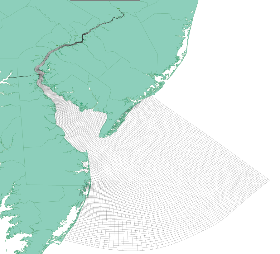
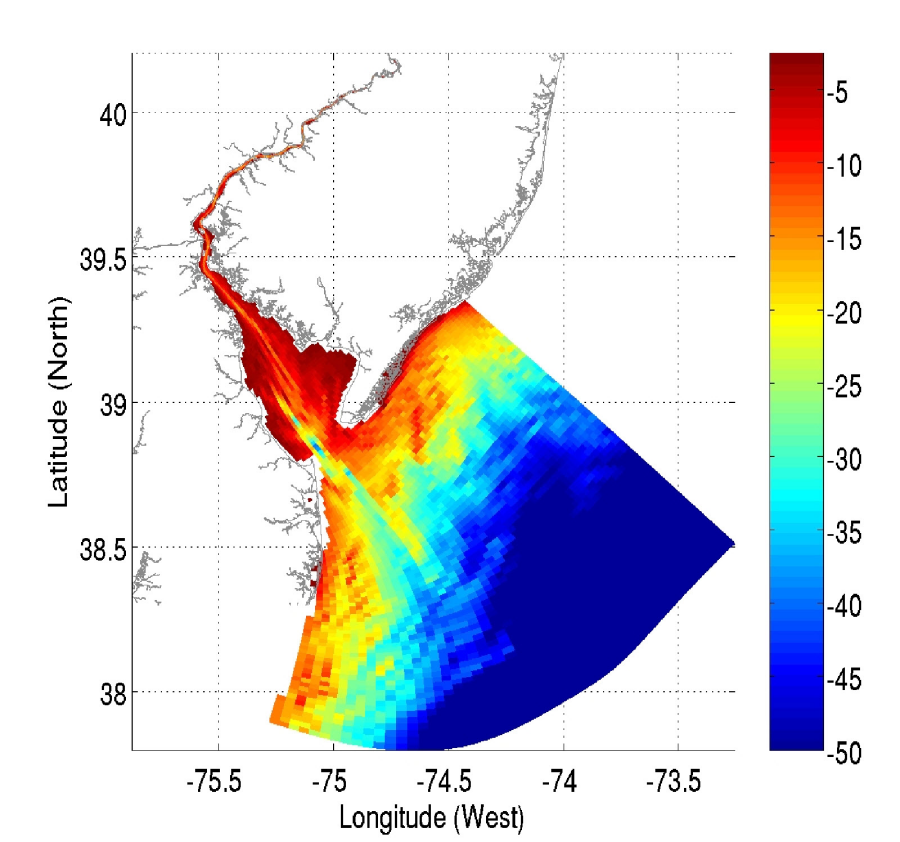
The DBOFS grid has 119 x 732 points in the horizontal. The grid resolution in the x- and y- directions ranges from 100m up to 3km. The vertical grid follows the terrain and consists of 10 model levels. The DBOFS model domain was designed to include the whole of the Delaware Bay and a piece of the shelf to allow a realistic interaction between the shelf and the entrance to the Bay. The DBOFS grid and spatial extent is indicated above. The bathymetry of the Delaware Bay is indicated below.
DBOFS runs on NOAA's High Performance Computers (HPC) in a new Coastal Ocean Modeling Framework (COMF) developed by CO-OPS. As a result, DBOFS has direct access to NWS operational meteorological products that it needs to run reliably. Nowcast and forecast guidance cycles are run 4 times a day (every 6 hours).
DBOFS output is in NetCDF format. An archive of DBOFS NetCDF nowcast and forecast files can be accessed from THREDDS server.
All CO-OPS official real-time products, including nowcast and forecast guidance from DBOFS are monitored by the CO-OPS's Continuous Operational Real-Time Monitoring System (CORMS). CORMS provides 24 hour per day, 7 day per week monitoring and quality control of sensors and data in order to ensure the availability, accuracy, and quality of tide, water level, current, and other marine environmental information. CORMS is intended to identify invalid and erroneous data and information before application of the data by real-time and near real-time users.

